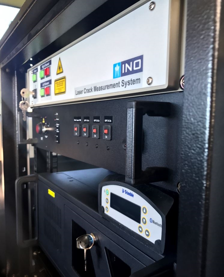
Laser Crack Measurement System
Automatically collect a wide variety of pavement defects using the latest laser scanning technology
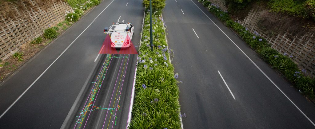
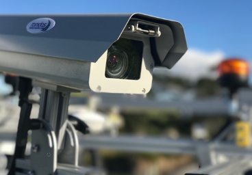
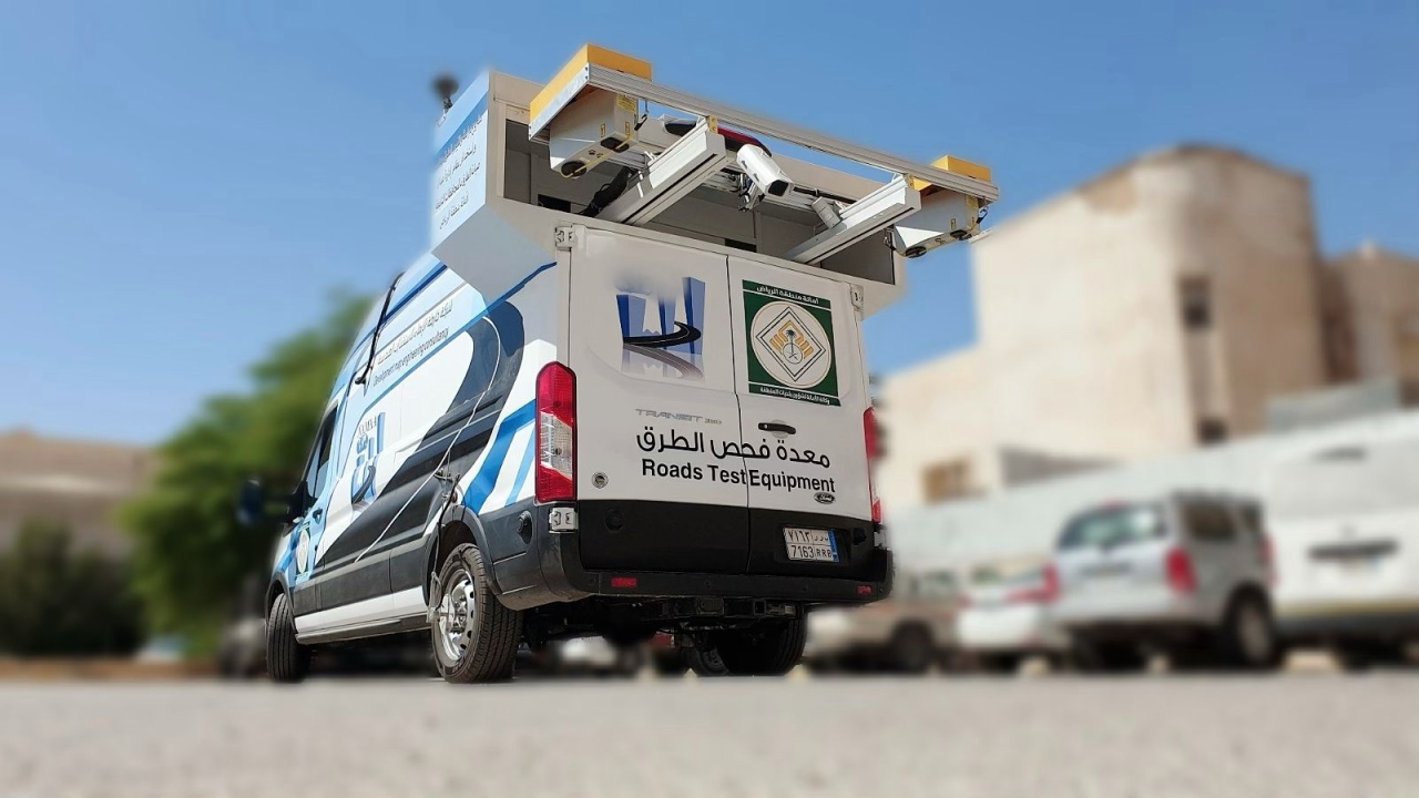
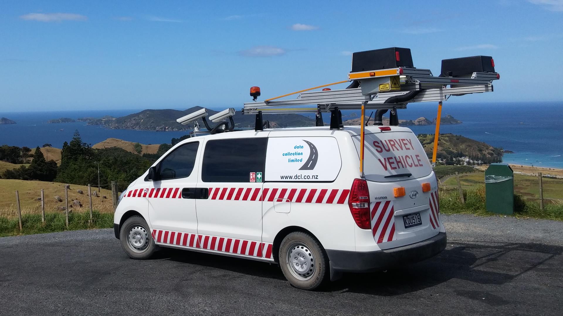
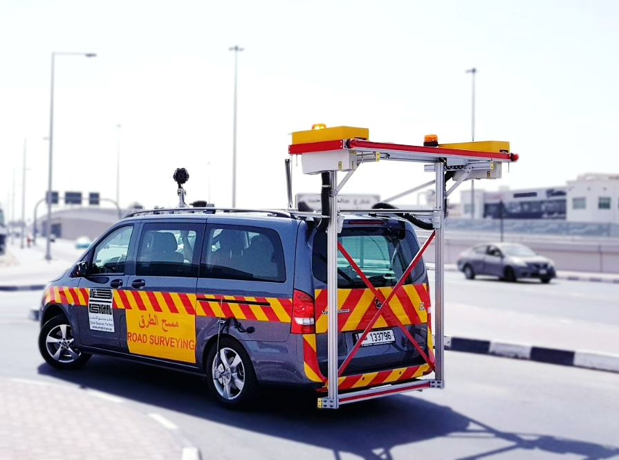
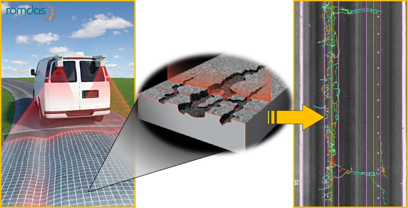
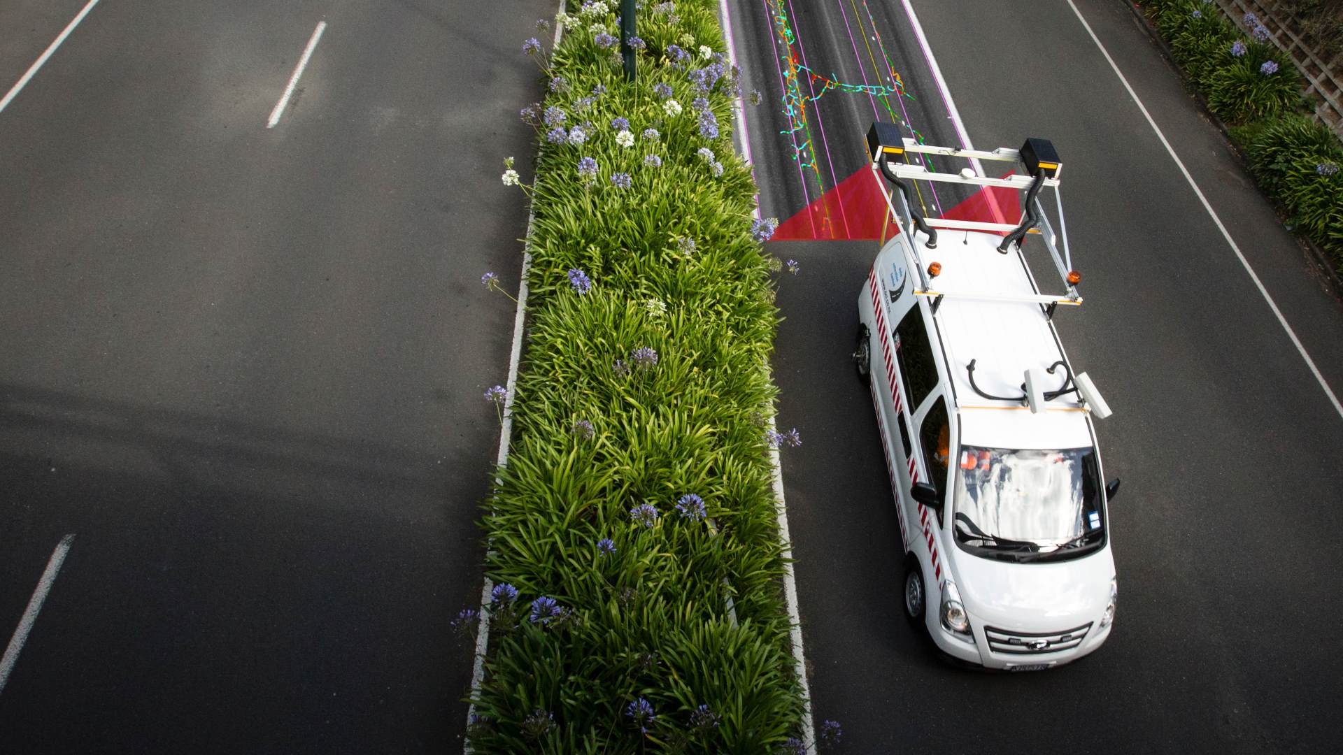
ROMDAS LCMS uses the latest laser scanning technology from Pavemetrics for automated road condition survey. LCMS collects high accuracy 3D road surface profiles for automated pavement condition surveys. These 3D profiles are then analysed using industry standard algorithms to calculate a variety of important datasets. Along with automated pavement crack detection and classification, this scanning laser unit also measures potholes, patching, rutting, macro texture (MPD), raveling and joints/faulting.
Thanks to its operating principle, the ROMDAS LCMS offers several practical features that ensure flexibility and quality of data collected at normal traffic speeds, and in day or night time. This multifunctional module is an excellent option for private and public entities wanting to perform high-accuracy network level road surveys without the need for traffic management.
Key Benefits & Features
- Exceptional price for a system utilizing Pavemetrics™ LCMS lasers
- Pavement images with cracking and defects automatically overlaid
- 4m width profiles with +4,000 points per profile
- Detects cracks down to 1mm
- Operates up to 100km/h
- Lane tracking feature for consistency
- Day or night operation
- Upgrade for airport FOD detection available*
- Add ROW cameras, GPS and other modules to supplement LCMS™ data
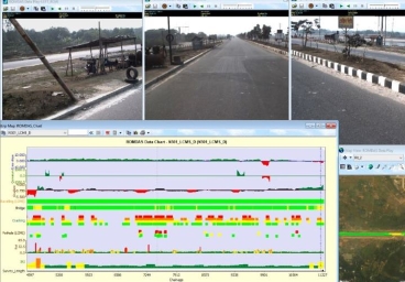
- Real-time display during surveying
- Non-proprietary data formats and easily exportable to Excel, GIS mapping or asset management systems
- Reprocess data using different parameters without re-surveying
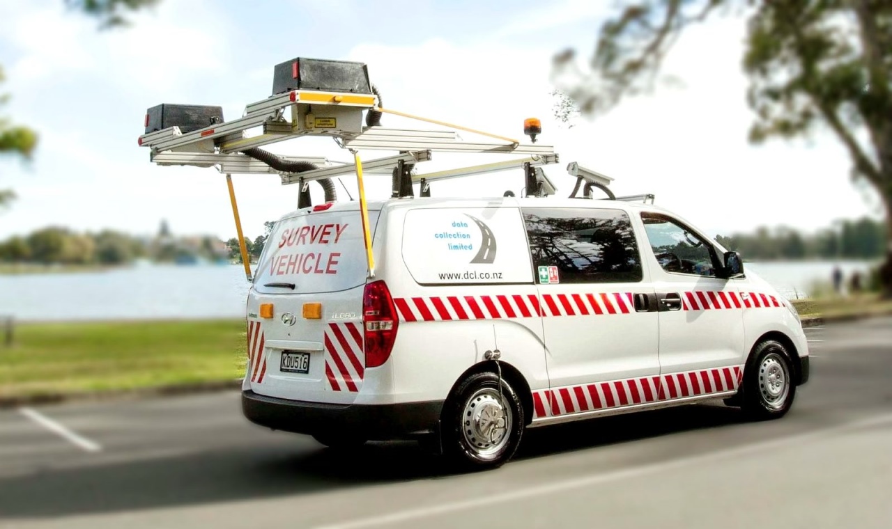
- Roof mounted, not bumper mounted, for increased mobility
- System powered by vehicle battery, no need for additional generators
Standard outputs
- Cracking (Longitudinal, transverse, alligator, multiple, sealed cracks)
- Potholes
- Rut depth, width & cross-sectional area for each wheel path
- Macro-texture (MPD) across whole lane width in 5 AASHTO band
- Bleeding
- Raveling
- Shoving
- Concrete joint/faulting
- Water pooling
- Lane Marking
- Pumping
- Patching
- Water entrapment
- Geotagged Pavement images (.JPEG)
- Longitudinal profile/Roughness (IRI in both wheel paths)*Optional Upgrade
- Geometry (slope, cross-fall, radius of curvature, super elevation)*Optional Upgrade
